Year-round light
How the sun finds this plot — and where the trees take it.
82% of available sun reaches the plot. The ground heatmap is a year-round model of sun-hours per 10 m cell; the photoreal scan below carries the real summer-solstice sun and the shade the 17 nearby trees actually cast. Modelled, not measured — a study to confirm on site, not a guarantee.
124 modelled sun-hours across 12 sampled days (1/month · 60-min steps).
Aerial · sun study
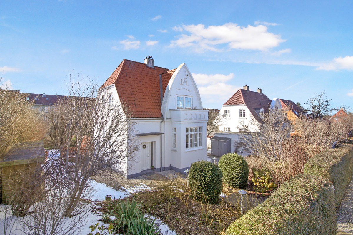
The solstice sun over Henriksvej 7
Scrub the day: the sun follows its real solstice arc while the modelled shadows of the house and trees sweep the garden.
- Gaussians
- 123.023
- Payload
- 4.1 MB
Aerial Gaussian splat + DHM surface shadow
Watch the sun cross the plot
A 4.1 MB Gaussian-splat capture with seasonal sun paths and the shadow the house and trees cast from the DHM surface model. Drag to orbit, scroll to zoom.
Scan + sun source
2-
Sun + shadow analysis (Sunshadow) -
Aerial Gaussian-splat capture
Daylight vs direct sun
The year in light
Tall bar = hours of daylight that day; green = modelled hours of direct sun on the plot. The gap is daylight the site never converts — low winter sun, behind the houses and trees.
Jan
Feb
Mar
Apr
May
Jun
Jul
Aug
Sep
Oct
Nov
Dec
Sun source
1-
Sun + shadow analysis (Sunshadow)
Georeferenced · north up
Where the sun lands on the plot
100 × 100 m · 10 m cells
Grid source
2-
Sun + shadow analysis (Sunshadow) -
Aerial Gaussian-splat capture
Summer solstice · 21 Jun 2.026
The sun's path on the longest day
Sun height (vertical) against compass bearing (horizontal), 05:33 → 21:33. It crests at 57,5° due south. This is the same motion the 3D scan animates — and the reduced-motion fallback for it.
Sun-path source
2-
Sun + shadow analysis (Sunshadow) -
Aerial Gaussian-splat capture
What this is — and isn't
- Modelled from terrain, building and tree geometry — not on-site light measurements. Treat it as a study to confirm, not a guarantee.
- The ground heatmap is the year-round model. The animated sun is a single day — the summer solstice — sampled each hour.
- 17 trees within 50 m (tallest 9,5 m) are folded into the shadows; drought risk from vegetation is high.